I love Space City Weather. We have light rain at my house right now
https://spacecityweather.com/tropical-system-will-pass-by-houston-today-lashing-parts-of-the-region-with-rain-before-moving-on/
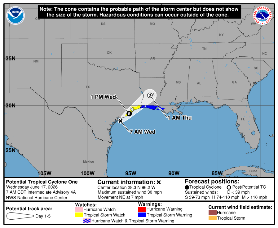
In brief: Central and southern parts of Houston are seeing rain from an approaching tropical system this morning, which should pass near Galveston Island later today. Winds should be mostly modest, and we expect rains over the Houston region to diminish by late morning or early afternoon.
Tropical update
As of 7 am CT a low pressure system lies just off the coast of Texas, near Matagorda Bay. According to the National Hurricane Center, it is moving to the northeast at about 7 mph and should continue to track more or less along the upper Texas coast today. This will bring its rather poorly defined center near Galveston Island sometime today, likely during the early afternoon hours. Although there remains a chance this system becomes a tropical depression or storm, whether it does so largely does not matter for the greater Houston region today as it passes by. The system’s effects are now essentially baked in.
Wednesday
Most of the Houston region saw a quiet night, but areas southeast of Houston, including Pearland, Clear Lake, and League City, picked up 2 to 3 inches of rainfall. Additional showers are now spreading into the Houston metro area this morning as the tropical system nears our region. These showers are likely to persist through the morning hours before lesser coverage this afternoon. Additional accumulations of 1 to 2 inches are possible, although most locations will see less than this. The impactful rains from this system are falling to the north and east of its center, so as the center moves near Galveston Island these rains should move on to east Texas and southern Louisiana.

 = new reply since forum marked as read
