Startling satellite data exposes invisible threat lingering in the air: 'Governments committed billions to technological [View all]
upgrades'
The amount of methane gas in the atmosphere has increased by two-and-a-half times since the pre-industrial era. Technological advancements in oil and gas production and coal mining have largely caused this increase in methane gas pollution.
Technological innovation has also made detecting the sources of this pollution easier to identify. Scientists are using techs ranging from satellites, planes, drones, and hand-held devices to detect the pollution.
What's happening?
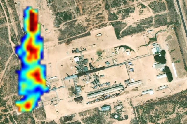
On Feb. 4, Momentick, a company that uses satellite imagery to detect, monitor, and stop planet-warming gas pollution, released its 2024 Methane Emissions Report.
The emissions intelligence company studied satellite imagery of nearly 277,000 square miles to identify methane pollution from oil and gas facilities. The satellite imagery showed that approximately 17% of the monitored facilities worldwide, one in six, are leaking large amounts of methane gas.
https://www.msn.com/en-us/money/other/startling-satellite-data-exposes-invisible-threat-lingering-in-the-air-governments-committed-billions-to-technological-upgrades/ar-AA1BtIE3
 = new reply since forum marked as read